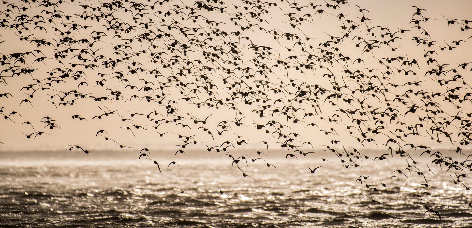
Snettisham Spectacular, The Wash
_What are the natural wonders of Norfolk
Discover how Norfolk was made... starting in the time of the dinosaurs
Norfolk has an amazing geological history, stretching all the way back to the time of the dinosaurs, including ice ages that changed the landscape, and the last land link between Great Britain and the Continent.
We’ve chosen our top natural wonders of the county that will give you an insight into how Norfolk was made and why it looks the way it does today. And you can visit them all year-round… although you’ll get wet for one.
‘No Norfolk Broads?’ you might ask. Absolutely not - they were mostly man-made.

Blakeney Point at high tide
Blakeney Point
Home to the largest seal colony in England during the Winter when the Greys have their pups, Blakeney Point was created by a process called longshore drift that also made Great Yarmouth. Here’s the science: the prevailing wind and tides acting on Norfolk’s shore come from the north-east and impact directly on Cromer where the pressure is pushed west and south, over time moving sand and creating spits across estuary mouths (in this case the River Glaven and also the Yare… hence Yare Mouth = Yarmouth).

Happisburgh beach
Deep History Coast and Cromer Forest-Bed
Created between half a million and two million years ago, the Cromer Forest-Bed stretches from Weybourne all the way down to Kessingland in north Suffolk and is rich in fossils. Found here has been the oldest and best-preserved mammoth skeleton in the world, a 550,000-year-old flint handaxe that was the Swiss Army Knife of its day and 850,000 human footprints that are the earliest evidence of footmarks found outside the Great Rift Valley in Africa. That's why it's the Deep History Coast.
This stretch of coast was also the last piece of Britain that was still joined to the Continent, until as little as 7000 years ago when the link, called Doggerland, was finally inundated. Even now the sea is very shallow here, as little as 100 metres deep, and that’s why it’s such a good place to put all those lovely wind farms you see just off the coast in Norfolk.

Roman Camp on the Cromer Ridge
Cromer Ridge
Okay, put your hand up if you think the highest point in all East Anglia with a sea view is in Norfolk, the county once described by Noel Coward in his play Private Lives as ‘Very flat, Norfolk’? No takers? Here’s a shocker for you… the highest point in all East Anglia with a sea view is at Beacon Hill behind West Runton.
This is the pinnacle of the Cromer Ridge, an almost 9-mile-long stretch of upland caused in the last Ice Age by a terminal moraine – a glacier that finally gave up the ghost and left behind all the material it had dredged up in its path. What’s also left behind is a natural adventure playground that includes Beeston Bump, a circular hill on the cliffs near Sheringham, the heathland ‘quiet lanes’ that are great for cycling and the heights of the National Trust’s Sheringham Park, from where you can enjoy unrivalled views along to the coast to Blakeney Point.

Flint cottage at Blakeney
Flint
Flint is an inescapable and indelible part of Norfolk’s history and landscape. It’s everywhere, in churches and abbeys, city walls, coastal cottages, Norwich’s amazing Guildhall, a Roman castle, and down a 4000-year-old Neolithic mine.

Sheringham beach
Great Chalk Reef
Okay, unless you’re a diver, you’re going to have our word for this, but just off the coast of Cromer and Sheringham is the longest chalk reef in the world, dubbed ‘Britain’s Great Barrier Reef’. At over 20 miles long, the 100-million-year-old reef is part of a chalk seam that stretches all the way to the white cliffs of Dover.
One way to enjoy the reef is to eat the famous Cromer Crab or a Sheringham Lobster – the reason they taste so sweet and are so meaty is because they feed off the reef.

Paddleboarding on the River Wensum, Norwich
River Wensum
The River Wensum does all the work, but the River Yare gets all the credit. Beside Whitlingham Broad outside Norwich at the confluence of those rivers (and the much smaller Tas which has the honour of running beside the Roman town at Caistor St Edmund), it’s the Yare that takes the water out to sea but it’s the Wensum, winding through the city and all the way up to Fakenham, that is by far the more important.
The Wensum is the longest, biggest and most significant of 160 chalk rivers in the UK. It’s also the most protected river in Europe. The river once had fifteen mills which benefited from the gradual fall of land.

Heathland at Syderstone Common, Brecks
The Brecks
As one observer in the 1760s commented, the Brecks was ‘sand and scattered gravel, a mere African desert’. Today, it includes the magnificent Thetford Forest, which was created by the Forestry Commission around the time of the first world war (so it’s more than 1000 years younger than the New Forest in Hampshire). There are also thousands of acres of wonderful heathland, formed thousands of years ago by, ironically, the felling and burning of forests for grazing land.
In the Brecks you’ll find prehistoric Pingos – no, nothing to do with the CBeebies – and unique lines of Scots pines called ‘Deal Rows’. You’ll also find an uneven landscape caused by Neolithic flint mining and rabbit warrens from Norman times.
The Brecks also enjoy the warmest, driest climate in the entire country.
Read more

Hunstanton cliffs on The Wash
The Wash and Hunstanton Cliffs
The Wash is one of the most important wetlands for wildlife in Europe and the best place to get a perspective on this unique tidal estuary is from the multi-coloured cliffs at Hunstanton, the base of which are made of stone that’s more than 140 million years old.
Read more about the Natural Wonders of Norfolk

Natural wonder of Norfolk: River Wensum and chalk streams
In the country’s driest and flattest county, you’ll find a series of spring-fed chalk rivers that…

Natural wonder of Norfolk: The Brecks
Described by Charles Dickens as ‘barren’ in David Copperfield, and by an observer in the 1760s as…

Natural wonder of Norfolk: The Wash and Hunstanton cliffs
Standing on the cliffs at Hunstanton are a perfect place to view the massive bay and estuary of The…

Natural wonder of Norfolk: Chalk Reef
Dubbed ‘Britain’s Great Barrier Reef’, the Cromer Shoal Chalk Bed, created when dinosaurs ruled the…

Natural wonder of Norfolk: Flint
If there’s one material that’s synonymous with Norfolk then it’s flint. You’ll see it everywhere,…

Natural wonder of Norfolk: The Cromer Ridge
Cromer Ridge is the highest coastal area of East Anglia at over 100 metres, is 8.7 miles long, and…

Natural wonder of Norfolk: Cromer Forest-Bed
The Cromer Forest-Bed Formation, aged between 500,000 and 2 million-years-old and stretching from…

Natural wonder of Norfolk: Blakeney Point
Managed by the National Trust since 1912 and within the Norfolk Coast National Landscape, Blakeney…
Plan your stay in Norfolk
All your questions about Norfolk answered, plus advice on how to plan your trip and things to do.
Read moreStay In Touch
Sign up for our newsletter for Norfolk holiday ideas, places to stay, seasonal guides and local events. We’ll share inspiration for days out, coastal breaks and countryside escapes, plus occasional highlights from across the county.
