_Natural wonder of Norfolk: The Cromer Ridge
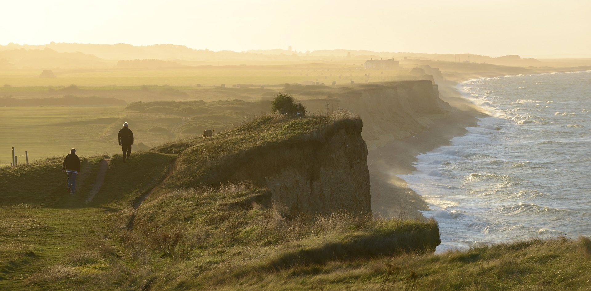
Cromer Ridge, Sheringham cliffs
You do wonder if Noel Coward had ever visited the county when he wrote in his play Private Lives: ‘Very flat, Norfolk’. Anyone who has walked or cycled on the Cromer Ridge, otherwise known as the ‘Norfolk Heights’, will know otherwise.
The ridge is the highest coastal area of East Anglia at over 100 metres, is 8.7 miles long, and is characterised by its irregular and undulating wooded topography and substantial areas of heather in the west. Sunken lanes, caused by water erosion, are another characteristic of the ridge.

Sheringham beach
The tallest point of the ridge is 103 metres behind West Runton at Beacon Hill, otherwise known as Roman Camp.
When the ice age was at its zenith, one third of the world was covered in ice and much of Great Britain was hidden under vast glaciers.
The glaciers and ice sheets moved huge amounts of debris, ranging from boulders to fine rock particles, and as the ice melted this rock debris, known as till or boulder clay, was deposited, forming new landscapes.

Beeston Bump to Sheringham
That’s how the Cromer ridge came to be – the result of a terminal moraine, the furthest advance of a glacier before it lost momentum and the material dredged up from what is now the North Sea poured out to form what we see today.
In fact, Norfolk is underlain by a bedrock of chalk, as demonstrated by the area’s chalk streams and chalk reef.
The eastern part of the ridge is a push moraine, best seen at Overstrand, which has a 60-metre cross-section showing spectacular ‘rafts’ of chalk, pushed into position by glacial movement. The highest cliffs on the Cromer Ridge are at Lighthouse Hill north of Overstrand, which offer great views of the area.

Views of the sea from Roman Camp
The western part of the ridge is composed of outwash sands and gravels deposited by rivers at the glacier edge, best seen at Telegraph Hill at Kelling Heath where you get a spectacular panorama of the coast. From the viewpoint you can see a steep northward-facing slope which would have been the glacier margin. There’s also a series of circular hills known as kames, most famously Beeston Bump, steep-sided mounds of sand and gravel deposited by the melting ice sheet.
For more fabulous views of the coast on the ridge visit the National Trust-run Sheringham Park, designed by Humphry Repton.
A little further west the ’Norfolk Heights’ give way to low-lying beaches and marshes, with the imposing landmark of Muckleburgh Hill standing out from the beachline. This is another distinctive glacial formation called a kame, a mound formed from sands and gravels deposited by a retreating glacier.
Other Natural Wonders of Norfolk

Natural wonder of Norfolk: River Wensum and chalk streams
In the country’s driest and flattest county, you’ll find a series of spring-fed chalk rivers that…

Natural wonder of Norfolk: The Brecks
Described by Charles Dickens as ‘barren’ in David Copperfield, and by an observer in the 1760s as…

Natural wonder of Norfolk: The Wash and Hunstanton cliffs
Standing on the cliffs at Hunstanton are a perfect place to view the massive bay and estuary of The…

Natural wonder of Norfolk: Chalk Reef
Dubbed ‘Britain’s Great Barrier Reef’, the Cromer Shoal Chalk Bed, created when dinosaurs ruled the…

Natural wonder of Norfolk: Flint
If there’s one material that’s synonymous with Norfolk then it’s flint. You’ll see it everywhere,…

Natural wonder of Norfolk: Cromer Forest-Bed
The Cromer Forest-Bed Formation, aged between 500,000 and 2 million-years-old and stretching from…

Natural wonder of Norfolk: Blakeney Point
Managed by the National Trust since 1912 and within the Norfolk Coast National Landscape, Blakeney…
Stay In Touch
Sign up for our newsletter for Norfolk holiday ideas, places to stay, seasonal guides and local events. We’ll share inspiration for days out, coastal breaks and countryside escapes, plus occasional highlights from across the county.
