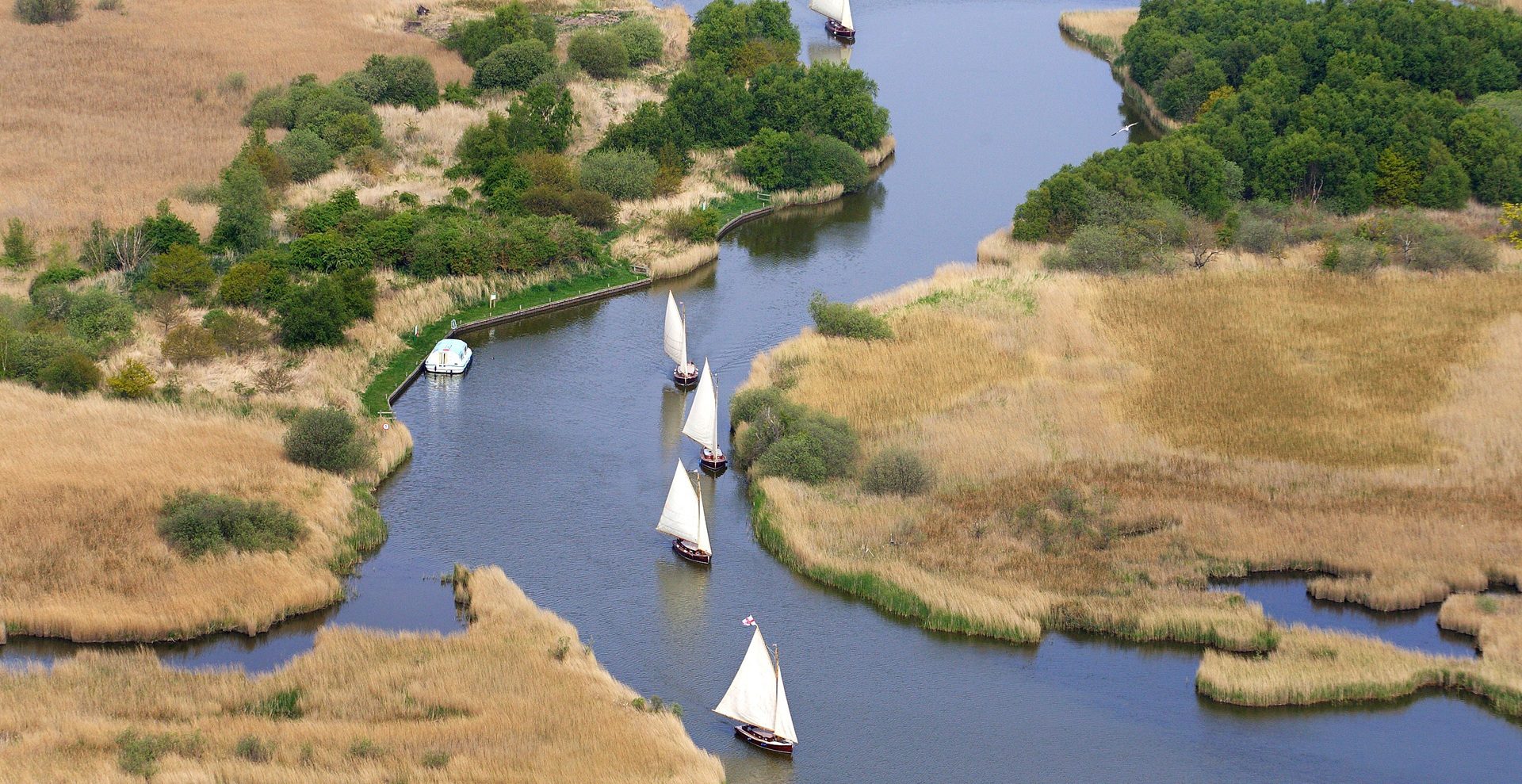
Sailing yachts in the Broads National Park
_How were the Broads made
The Broads are the only National Park made by man
Were the Broads created by natural processes?
We head to the Broads National Park for leisurely walking and cycling, pottering about on boats, relaxing by the waterways or wildlife watching. This is the birthplace of the boating holiday – and they’ve taken 2000 years to form.
Are the Broads man-made?
They look natural and are rightly regarded as the best example of a lowland wetland system in Britain, but they are actually a man-made phenomenon, the result of inundated medieval peat diggings, mismanagement of the environment by mankind, and climate change.
The conventional theory was that the Broads had been created naturally. In JN Jennings’ 1952 book, The Origin Of The Broads, published by the Royal Geographical Society, the stratigrapher concluded that the lakes had been formed by natural processes. But his apparently definitive interpretation was about to be challenged… by a female rival!

Geldeston Three Rivers camp site, River Waveney. Credit Visit the Broads
Botanist Joyce Lambert was born in London but brought up in Brundall, Norfolk. She was educated at Norwich High School for Girls, and graduated from University College of Wales, Aberystwyth. After a stint as a schoolteacher in Norwich she was appointed lecturer in botany at Westfield College, London and, mentored by Norfolk naturalist Ted Ellis, she was encouraged to study the ecology of the Surlingham and Rockland area.
Dr Lambert’s investigation of the Bure and Yare Valley broads and fens coincided with Jennings’ work – but she came to a very different conclusion, one that would challenge received wisdom.

Paths and trails across the Broads are accessibility-friendly. Credit Visit the Broads
How were the Broads made?
Dr Lambert’s research revealed that the sides of the deep lakes were vertical and not gently sloping as would be expected of a naturally formed lake. She also found their floors, just some three metres or so below the surface, were almost flat. This, coupled with the historical evidence of demand for fuel, proved irrefutable – the Broads were actually the result of medieval peat-digging after clearing of the alder carr, waterlogged wooded land.
In 1952, the same year Jennings’ book was published, Dr Lambert gave the presidential address at the Norfolk and Norwich Naturalists’ Society, revealing her new findings. These, together with a follow-up article in the Geographical Journal, caused a sensation.
Backed by Cambridge University, a multidisciplinary team, including Dr Lambert, was set up. Their findings were to be published in a second Royal Geographical Society memoir, The Making Of The Broads (1960). The team noted that there was documentary evidence, especially from Norwich Cathedral, that substantial amounts of peat had been dug for fuel between the 12th and 14th centuries, in a region which was then one of the most economically successful and populous parts of the country.
The largest was the Isle of Flegg, a huge area of land hemmed in by the River Thurne and River Bure.

Salhouse Broad. Credit Visit the Broads
But materials for living became scarce. Timber and fuel supplies were drained as much of the woodland areas were cleared to make way for sheep grazing – the word field derives from the German feld, cutting down trees.
Sheep rearing to make wool for cloth became a hugely successful venture, making Norfolk the wealthiest county and Norwich the second largest city in the British Isles. Trade across the North Sea to lucrative European markets was established. At that time, it was quicker to get to Amsterdam than it was London.
A new source of fuel had to be found. It was at this time that peat digging, also known as ‘turbary’, was tapped into and this provided a suitable fuel alternative. Dr Lambert’s research revealed that local parishes possessed ‘turbary rights’ to dig peat in their own areas, which coincided with the configurations of parish boundaries within the Broads.
Imagine a time when there were no mod cons, no electricity and certainly no mechanical diggers – just manpower and a need to survive in what would have been difficult and unforgiving times. In the 12th century the population of east Norfolk was growing rapidly and the area was documented to be the most densely populated in Britain.
Another clue was that the area’s names were not Anglo-Saxon or Norse. They were named after people or landmarks, meaning they originated later.
The extraction of peat would have been a difficult and unpleasant task, requiring great physical effort by hand. Yet it was a prosperous industry and provided fuel for both individual families and manors, with a greater proportion being sold. It is estimated that more than 900 million cubic feet of peat would have been extracted.

Norwich Cathedral
Norwich Cathedral records from the Middle Ages show that the building burned over 400,000 turves of peat a year. Indeed, the diggers had excavated to a depth or three metres to gain access to brushwood peat, because its calorific value was superior to that of material near the surface. It's thought an estimated 900 million cubic feet was excavated for fuel over 200 years.
Digging took place throughout all the east Norfolk settlements until the 14th century. Digging for peat created huge holes in the landscape and as the climate changed, sea levels rose and the rivers inundated those excavations to create huge areas of open water - the iconic National Park and its 41 Broads, the largest being Hickling at 141 hectares.
Where once there had been peat digging, there were now economically important fisheries.
But eventually rising sea levels inundated the lakes and they were joined to the area’s many rivers. What had once been ‘holes’ were much later to become a popular tourist destination.
Over 200 km of navigable Broads and rivers had been created and these provided essential channels for communication and commerce throughout the 16th century.
Norwich was the second largest city in England after London and its tradable goods of wool, weaving and agricultural produce were exported throughout the world from the port of Great Yarmouth. The waterways were also used to transport coal, bricks, timber and tiles.

Wherry Albion
The boats that plied these routes were large Norfolk Wherries, with their single black sail and shallow keel, and smaller, square-sailed flat boats.
But with no fast-running water, Norwich was left behind by the Industrial Revolution, leaving much of its medieval centre intact.
It was the Victorians who reimagined the area when entrepreneurial wherry captains began transporting holidaymakers rather than coal and reeds and by the end of the 19th century, operators rented small yachts to amateur sailors.
Dr Lambert retired in 1979 and returned to live in the Yare valley house built by her grandfather in the early 1920s. She died on May 4, 2005, aged 88. It’s only thanks to her we know that Norfolk has the only man-made National Park in the country!
For those wishing to discover more about the fascinating history of the Norfolk Broads visit the Museum of the Broads in Stalham where you can see how the mystery was solved. You’ll also find Dr Lambert’s auger tool used to take mud samples for analysis, as well as her typewriter, mascot coypu, and copies of her work.
Today the Norfolk Broads can still evoke a sense of disbelief in new visitors when they realise they are in the only man-made National Park in the UK.
How did the Broads develop through history?
When the Romans were here, Great Yarmouth didn’t exist and what we now know as the Broads were marshes, fen, reeds and islands. Back then the water-logged peat soil was a series of islands.

Great Yarmouth beach and Breydon Water
How was Great Yarmouth made?
It would be another 700 years before longshore drift created a sandbank across the Gariensis estuary mouth that eventually became the east coast’s top seaside resort – Great Yarmouth.
The sand spit across the estuary was used by fishermen and by 1086 the Domesday Book recorded a small borough with a church, 70 burgesses and 24 fishermen belonging to the neighbouring manor of Gorleston.
In Saxon times, Acle was on the shoreline and was a prominent port – some properties in the village, built on the line of the beach, have front gardens of sand and back gardens of flints. In the Domesday Book, it was noted that Acle has 23 villagers, 38 smallholders and three slaves!
As the estuary gradually silted up to become the Breydon Water we see today, rivers were formed, and embankments were created during the 13th and 14th centuries to claim valuable farming land.

St Benet's Abbey on the River Bure
Why is St Benet’s Abbey unique?
A medieval site to visit is the 1,000-year-old St Benet’s Abbey on the River Bure, which linked the rural landscape to the bustling city of Norwich. The Abbey was the only one in the country not officially closed when Henry VIII was shutting the monasteries, and the Bishop of Norwich still officiates at a service every year to ensure it stays consecrated, arriving by wherry.

A wherry on the Broads
What is a wherry?
The unique landscape of the Broads meant a unique boat, the shallow-keeled, black sailed wherry, was needed to transport goods like herring, coal and wool to and from Great Yarmouth, which had strong links with the Low Countries. In fact, it’s said it was quicker to sail to Amsterdam than to get to London.
Today, the Broads can be enjoyed on foot and by cycle, but the best way is undoubtedly by boat from which you can explore 125 miles of lock-free navigable waterways. To put that into perspective there are just 30 miles of canals in Venice and 60 miles in Amsterdam.

Traditional re-thatching of a roof at Horsey Staithe
You might see reed cutting for thatching properties, you’ll see wildlife from birds to otters, and you’ll definitely see lots of windpumps and windmills, not least because the flat landscape offers amazing views. It’s said the windmills were brought back from the Middle East by Crusaders and the windpumps were the instrument by which the land was drained to provide the pasture and arable land we enjoy today, very different from 2000 years ago.
Learn more at the Museum of the Broads
Things to do and places to stay in the Broads

Eastwood Whelpton Sailing
Eastwood Whelpton offers boat hire and sailing holidays on the Norfolk and Suffolk Broads.… Eastwood Whelpton offers boat hire and sailing holidays on the Norfolk and Suffolk Broads.…

Eastwood Whelpton Sailing
Eastwood Whelpton offers boat hire and sailing holidays on the Norfolk and Suffolk Broads.…

Manor Farm
This traditional thatched and timber-framed farmhouse retains its original lavish oak partitions… This traditional thatched and timber-framed farmhouse retains its original lavish oak…

Manor Farm
This traditional thatched and timber-framed farmhouse retains its original lavish oak partitions…

Broadland Country Park
This beautiful mosaic of heath, woodland and marshy grassland, nestled between Horsford and… This beautiful mosaic of heath, woodland and marshy grassland, nestled between Horsford and…

Broadland Country Park
This beautiful mosaic of heath, woodland and marshy grassland, nestled between Horsford and…

Poolside Lodges
Three hot tub lodges set around a seasonal heated pool, perfectly placed for Norwich and the… Three hot tub lodges set around a seasonal heated pool, perfectly placed for Norwich and the…

Poolside Lodges
Three hot tub lodges set around a seasonal heated pool, perfectly placed for Norwich and the…

Aylsham Windmill
Converted Corn mill, Aylsham, in the centre of North Norfolk. Between the City of Norwich and the… Converted Corn mill, Aylsham, in the centre of North Norfolk. Between the City of Norwich and…

Aylsham Windmill
Converted Corn mill, Aylsham, in the centre of North Norfolk. Between the City of Norwich and the…

Cycle Breaks
Discover the very best of Suffolk on two wheels with this immersive, self-guided cycling adventure… Discover the very best of Suffolk on two wheels with this immersive, self-guided cycling…

Cycle Breaks
Discover the very best of Suffolk on two wheels with this immersive, self-guided cycling adventure…

Sutton Staithe Boatyard
Environmentally friendly Electric Picnic Boats, Electric and Diesel Day Boats, Canoe and Kayak Hire. Environmentally friendly Electric Picnic Boats, Electric and Diesel Day Boats, Canoe and Kayak…

Sutton Staithe Boatyard
Environmentally friendly Electric Picnic Boats, Electric and Diesel Day Boats, Canoe and Kayak Hire.

Sykes Holiday Cottages Norfolk
Discover your next escape to Norfolk with Sykes Holiday Cottages. Discover your next escape to Norfolk with Sykes Holiday Cottages.

Sykes Holiday Cottages Norfolk
Discover your next escape to Norfolk with Sykes Holiday Cottages.
Plan your stay in the Broads National Park
All your questions about the Broads National Park answered, plus advice on how to plan your trip and things to do.
Read moreStay In Touch
Sign up for our newsletter for Norfolk holiday ideas, places to stay, seasonal guides and local events. We’ll share inspiration for days out, coastal breaks and countryside escapes, plus occasional highlights from across the county.
