_Where is the Deep History Coast in Norfolk
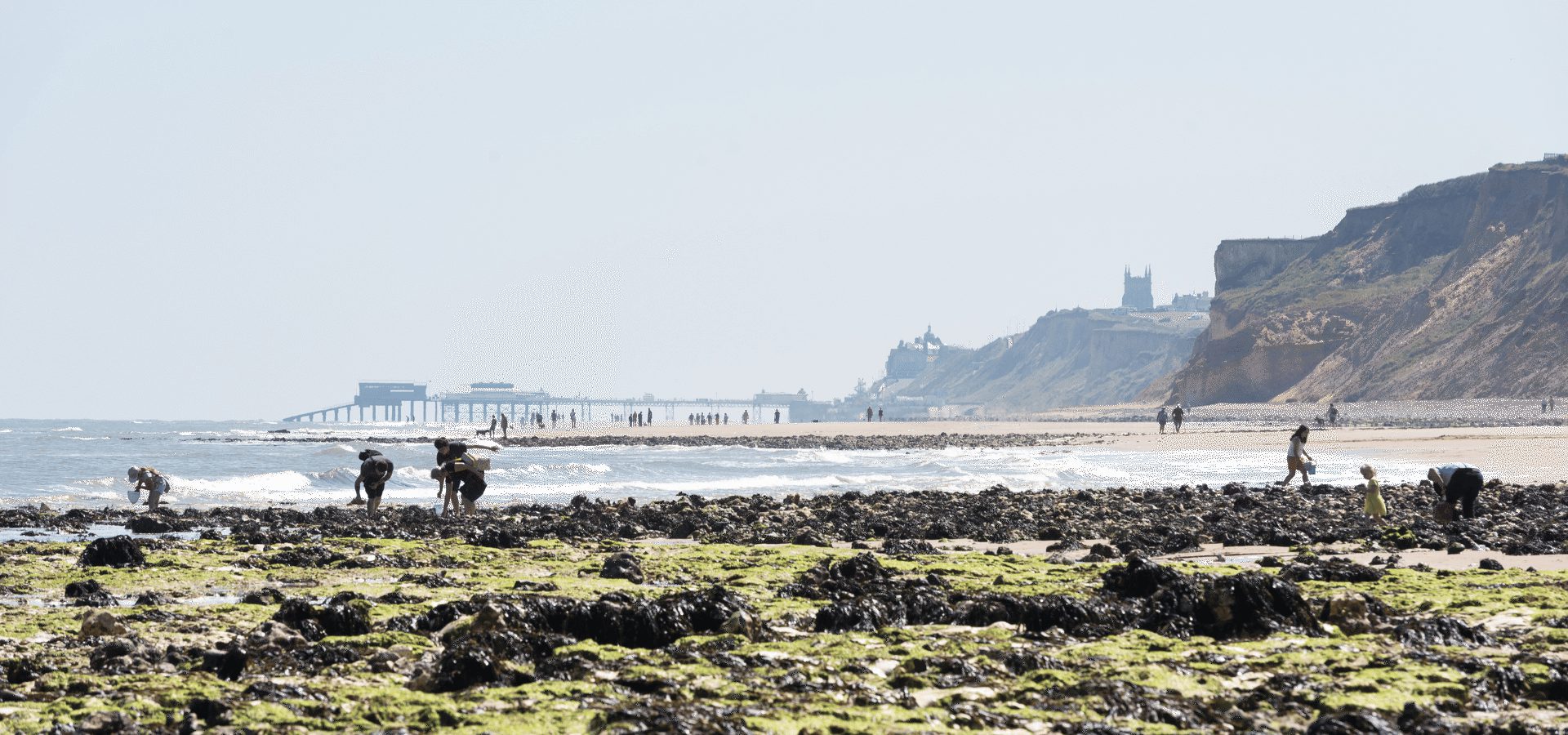
West Runton beach with Cromer Pier in the background
The Deep History Coast is the cradle of British civilisation, where you can walk in the footsteps left by the UK’s first tourists nearly one million years ago.
Palaeontologist Professor Richard Fortey said, ‘This is a place to feel the ephemeral grasp we have on the past’. The Deep History Coast is one of the world’s most important archaeological sites.
You’ll be amazed that recent discoveries along Norfolk’s coast show this apparently quiet and rural part of the country to have been the cradle of humankind for the whole of north-west Europe. Norfolk’s geography and coastal geology reveal unique vital clues to the earliest history of the human species and its natural environment. And discoveries continue to be made.
Finds in Norfolk have been vital in helping us understand how the story of Britain began and prompted archaeologists to rewrite the story of humankind in Europe. Highlights include:
- The oldest human footprints outside The Great Rift Valley in Africa, almost a million years old – the first tourists to the British Isles came to visit Norfolk.
- The largest and best-preserved prehistoric mammoth skeleton ever found in the British Isles – eaten by hyaenas 650,000 years ago.
- A half-a-million-year-old flint handaxe that was the Swiss Army Knife of its day.
- A unique Neanderthal mammoth butchery.
- The Bronze Age wooden equivalent of Stonehenge.
Who knows what you might find for yourself beachcombing on Norfolk Coast’s unique and ever-changing Deep History Coast, a 16 mile stretch from West Runton to Happisburgh via Cromer’s chalk reef (the reason Cromer crab is so sweet), the Cromer Ridge (the highest point in East Anglia with a sea view) and prehistoric Cromer Forest-Bed which stretches from Weybourne to Pakefield in Suffolk. There are more than 20,000 fossil finds a year reported to the Norfolk Museums Service.

Mammoths and hyaenas in Doggerland on the Deep History Coast
In prehistory, Britain was a peninsula with the coast stretching from what is now Yorkshire to the northern tip of Denmark. The UK was then physically joined to mainland Europe as recently as 8,500 years ago, with Norfolk providing the last ‘land bridge’ to and from the Continent before what came to be known as Doggerland finally succumbed to the North Sea waves.
The Norfolk coastline suffers for its exposed location from strong seasonal gales and storms. The coast here is vulnerable to flooding and reclamation by the sea. In 1604, the entire village of Eccles was lost to the sea. Today, this is the fastest-receding coastline in the whole of Europe. In just two months in 2003 at Happisburgh, 13 metres of coast was lost to the sea.
Although prevailing weather conditions pose an alarming threat to coastal communities and farmland, the resulting erosion has been responsible for a series of outstanding archaeological and palaeontological discoveries.
Norfolk’s Deep History Coast is one of the best places in the British Isles to find fossils. They connect us with our distant ancestors but also form a link with the history of life on earth.

Sheringham cliffs on the Deep History Coast
What is the Deep History Coast?
This is the land that has changed our understanding of pre-prehistoric times (hence Deep History – this is Earth’s equivalent of Deep Space), containing the most important archaeological site in Western Europe, the best-preserved Neanderthal site in the country and Norfolk is the only county in the British Isles where evidence of four species of human has been found.
What was prehistoric Norfolk like?
Norfolk would have been on the edge of a great fertile plain – similar to East Africa’s Serengeti – that was grazed by vast herds of animals similar to those still found on the African savannah in the estuary of a river system that flowed into the sea and included the Thames (yes, the Thames used to be in Norfolk) which was fed by a bigger but now extinct river called the Bytham.
The northern coastline was a landscape of lagoons, saltmarsh, rivers and lakes. The environment was perfect for humans to fish, eat shellfish and hunt wildfowl.
The Bytham River flowed from the Midlands near Leicester, across Norfolk’s now-fenland near King’s Lynn to Lowestoft. A smaller River Thames joined it from the south-west.
The Bytham River was destroyed by the Anglian Glaciation of 500,000-424,000 years ago when a thick sheet of ice covered the region, extending as far as Clacton and Thurrock in Essex. It also forced the ancestral Thames south to its present location.
The legacy of ice ages in East Anglia is the gentle landscape that we see today, which is the newest and flattest part of the British Isles in terms of its geology. The lack of high hills reveals the big skies that have inspired a host of artists, including Constable, Gainsborough and the Norwich School.

Erosion at Happisburgh has revealed more of the Deep History Coast
What was Doggerland?
During the period of the last Ice Age, the Devensian Glaciation, around 27,000 years, a large part of Britain and what is now the North Sea was covered in ice. The sea level was 120 metres lower than it is now and the land between what is now the British Isles and Europe has been called Doggerland.
The link to the European mainland, known as Doggerland, was lost only after the final thawing of the Ice Age. At the time Doggerland separated The Thames estuary and the southern North Sea.
Towards the end of the Devensian period, the last Ice Age around 10,000 years ago, huge glaciers melted and the sea level rose. As the weight of the ice lessened the land started to tilt and the dry land of Doggerland became submerged just 8,500 years ago. What was a peninsula became cut off from Europe, with Norfolk the last land link to the Continent.
With the sea between Norfolk and the Netherlands being shallow, fisherman have recovered bones of giant extinct animals such as woolly mammoth and woolly rhinoceros, as well as wild horse, bison, lions and hyaenas.
Who were the first tourists ever to visit the UK?
The foreshore at Happisburgh has revealed the oldest archaeological site in northern Europe with the oldest human footmarks found outside Africa’s Great Rift Valley. These were amongst the earliest Neanderthal visitors, nomads hunting mammoths, bison, rhinos and deer – if they could get them before the lions and hyaenas.
The footprint find came purely by chance in May 2013, after severe storms washed away much of the beach, revealing an expanse of hardened ancient estuary mud from the Cromer Forest-Bed. A team of British Museum, Natural History Museum and Queen Mary University of London scientists happened to be conducting a geophysics survey on the shoreline.
Indented in the mud surface they found footprints dated to at least 850,000 years old. The previous oldest footprints found in the British Isles were just 6,600 years old. The Happisburgh footprints were the oldest recorded outside Africa’s Great Rift Valley, the Cradle of Civilisation.

Prehistoric footprints left at Happisburgh with a camera lens caps for comparison
The footprints were quickly eroded by incoming tides but not before replica models were made from 3-D photography. Computer modelling revealed forty-nine footprints of several individuals, ranging from 14cm to 27cm in length, suggesting children and adults of the Homo antecessor human (Pioneer Man).
The hollows revealed in the mud were found to be the marks of heels and toes. It’s almost certain the largest footprints, representing a size 9 in today’s UK measurements, were made by an adult male of about 1.73m (5t 9in) tall. He was probably accompanied by an adult female and three children. The group was walking in a southerly direction along an estuary next to a slow-moving river.
It’s thought the nomads were perhaps pausing to gather plants or shellfish, or were even rock pooling, as families do today. We can say these were the first tourists ever to visit the UK.

Mammoth bones were found in the cliffs at West Runton
What is the West Runton Mammoth?
West Runton, in the Cromer Forest-Bed, yielded the oldest and most complete specimen of a mammoth to have been found in the British Isles and the biggest elephant skeleton ever found.
A pelvic bone was found exposed at the bottom of cliffs by West Runton couple Harold and Margaret Hems in December 1990 after a weather-ravaged night.
A year later, another storm revealed more bones and in January 1992 an exploratory dig was carried out, followed by a three-month excavation in 1995. It unearthed the most complete skeleton of a mammoth, from the species Mammuthus trogontherii – also known as a steppe mammoth.
The excavation recovered an approximately 85 per cent intact skeleton – with the only missing bits having been eaten by scavenging hyaenas. Some of the bones have hyaena bitemarks and fossilised hyaena poo found nearby was dissected and discovered to contain mammoth bone.
Dated around 650,000-years-old, the West Runton mammoth stood at least 4m to the shoulder and would have weighed about 10 tonnes – twice the weight of today’s African elephants. Except for the largest dinosaurs, it is probably one of the biggest animals ever to have lived on land, and twice as large as anything found on the Jurassic Coast.
At the time, with the British Isles still connected to Europe as a peninsula, there would have a slow-moving river in a flat landscape that was rich in grassland, woodland plants and animals, like an African savannah. The climate at the time would have been the same as now.
Those animals would have included prides of lions, packs of wolves and clans of spotted hyaenas as well as European jaguar and lynx. Plus, rhinos, giant deer and bears, bison and macaque monkeys.
A later Ice Age drove many of these animals to southern Europe, some species did not survive and became extinct, and others evolved such as reindeer, bison, woolly mammoths and woolly rhinos.
Where can I see the West Runton Mammoth?
You can now see some of it in Cromer Museum and Norwich Castle Museum with the mighty skull, tusks and more bones stored in The Norfolk Collections Centre at Gressenhall Farm and Workhouse.

The Happisburgh flint handaxe, the Swiss Army Knife of its day
The Happisburgh handaxe – the Swiss Army knife of its day
In 2000 in peaty sediment on the shoreline at Happisburgh beach a beachcombing amateur archaeologist Mike Chambers found a perfectly complete 550,000-year-old prehistoric hand axe.
The Palaeolithic tool had been preserved in a dense peaty deposit in a former forest. Discovered by a dog-walker in 2000, it led to other even older significant tool and bone finds at a spot that gives up its secrets as coastal erosion takes hold.
At the time this find pushed back the evidence for human colonisation this far north by at least 100,000 years.
The flint tool the cutting-edge technology of its time, the Swiss Army knife of its day. The handaxe could be utilised in many ways just by angling he way it was held. Some objects are so important they change our knowledge of human history – and this is one.
Analysis of pollen in the silt allows us to build a picture of temperate woodland with pine, alder, oak, elm and hornbeam in evidence at the time the handaxe was made. At this time the land here would have had lions, giant hippos and mammoths roaming.
The ‘Happisburgh hand axe’ is now on permanent exhibition at Norwich Castle Museum.
Together with modern humans, Homo sapiens, Norfolk is the only county in the British Isles with evidence of four species of humans: Homo antecessor and Homo heidelbergensis on the Deep History Coast and Homo neanderthalensis inland at Lynford. All of them made tools, mostly from flint, and each with their own manufacturing styles.
Is there a mammoth butchery in Norfolk?
Britain was deserted of humans between 180,00 and 65,000 years ago. At the end of that time, humans in the form of Neanderthals returned. Lynford, inland in the Brecks, provides evidence for the earliest human presence in the country after an absence of some 115,000 years.
Set in a group of gravel pits on a flood plain terrace on the south bank of the River Wissey, the gravels were deposited during the Ice Age. In 2002 a number of woolly mammoth teeth were found with a perfect black flint handaxe, a bout-coupe form only used by the Neanderthals. It was dated to between 64,000-67,000 years, some 30,000 years before the first modern human were thought to have arrived in the British Isles.
Beside a river where large animals and predators would have come to drink, the site yielded evidence of flint tools being used to cut meat from large carcasses – evidence of a mammoth butchery. The remains of at least nine woolly mammoths (Mammuthus primigenius) were found. The Neanderthals would have used the handaxes to cut meat from bones which was then carried away to be eaten, safe from other predators.
At nearby West Tofts, a 250,000-year-old flint hand axe was found that features a fossil scallop shell in its centre. The artefact’s maker had carefully chipped around the fossil so it sat undamaged in the centre of the axe – an early example of artistic awareness.

Seahenge display at King's Lynn Museum
What is Seahenge?
More recently, just 21 centuries before Christ, in other words 4200 years ago, Seahenge was created. Compared to the finds above, Seahenge was practically yesterday.
Found on the beach at Holme-next-the-Sea, near the Norfolk Wildlife Trust’s Holme Dunes, close to Hunstanton, after tidal surges in Spring 1998, like Stonehenge it was constructed in circles, although Seahenge was made of tree trunks, and both probably had religious or ritualistic purposes.
Originally constructed inland, Seahenge had an inverted tree trunk at the centre of an oval 56-post enclosure.
Where can I see Seahenge?
Many of the original timbers and the central stump are now on permanent display at Lynn Museum, at King’s Lynn.
Archaeologists clashed with protesters when they began removing the Bronze Age timbers from the beach. They found the oak trees were felled in 2049BC and by analysing axe marks found society was more advanced than had been believed, because metal tools were commonplace.
Plan your stay on the Norfolk Coast
All your questions about The Norfolk Coast answered, plus advice on how to plan your trip and things to do.
Read moreThings to do and places to stay on the Norfolk Coast

The Cliftonville
Creating memories since 1897, The Cliftonville offers a warm and genuine welcome in the heart of… Creating memories since 1897, The Cliftonville offers a warm and genuine welcome in the heart…

The Cliftonville
Creating memories since 1897, The Cliftonville offers a warm and genuine welcome in the heart of…

Wolterton
Set amidst 500 acres of stunning nature, this historic home is a perfect hideaway for the most… Set amidst 500 acres of stunning nature, this historic home is a perfect hideaway for the most…

Wolterton
Set amidst 500 acres of stunning nature, this historic home is a perfect hideaway for the most…

Aylsham Windmill
Converted Corn mill, Aylsham, in the centre of North Norfolk. Between the City of Norwich and the… Converted Corn mill, Aylsham, in the centre of North Norfolk. Between the City of Norwich and…

Aylsham Windmill
Converted Corn mill, Aylsham, in the centre of North Norfolk. Between the City of Norwich and the…

Faire Sailing Ltd
Sailing and powerboat tuition Sailing and powerboat tuition


Bishop’s Boats Seal Trips
See the Blakeney Point seals in their natural environment, basking on the Blakeney Point or… See the Blakeney Point seals in their natural environment, basking on the Blakeney Point or…

Bishop’s Boats Seal Trips
See the Blakeney Point seals in their natural environment, basking on the Blakeney Point or…

Beach Stays
Beach Stays brings together a handpicked collection of beach holiday homes across the UK and… Beach Stays brings together a handpicked collection of beach holiday homes across the UK and…

Beach Stays
Beach Stays brings together a handpicked collection of beach holiday homes across the UK and…

Cycle Breaks
Discover the very best of Suffolk on two wheels with this immersive, self-guided cycling adventure… Discover the very best of Suffolk on two wheels with this immersive, self-guided cycling…

Cycle Breaks
Discover the very best of Suffolk on two wheels with this immersive, self-guided cycling adventure…

Sykes Holiday Cottages Norfolk
Discover your next escape to Norfolk with Sykes Holiday Cottages. Discover your next escape to Norfolk with Sykes Holiday Cottages.

Sykes Holiday Cottages Norfolk
Discover your next escape to Norfolk with Sykes Holiday Cottages.
Stay In Touch
Sign up for our newsletter for Norfolk holiday ideas, places to stay, seasonal guides and local events. We’ll share inspiration for days out, coastal breaks and countryside escapes, plus occasional highlights from across the county.
